|
Many thanks for permission to use graphics from their software and toposheets |
|
|
Day 1Cascade Kauri Park to Mountain Rd, HendersonFor a more detailed photo record of the tracks involved:
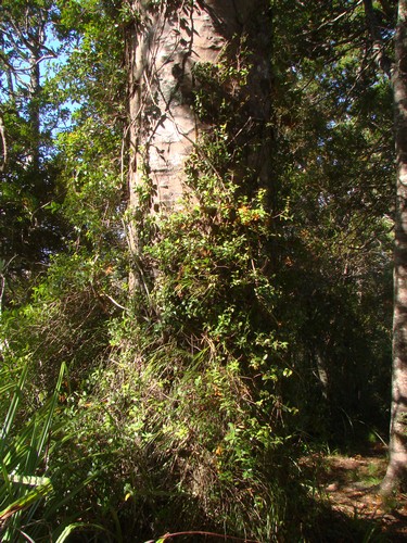
Cascade Kauri Park borders the Waitakere Golf Course at the end of Falls Rd. The carpark is large and generally populated, but I have seen piles of broken glass, nevertheless. Don't leave valuables where they can be seen or guessed at. In the boot is better than under a rug on the back seat. There's a toilet here, and drinking water available. This is also the start and finish point for the Montana Heritage Trail. Most of the Waitakere Ranges are administered by the ARC, and are dog tolerant if not welcoming. However, Cascade Kauri is one of the Ark in the Park release areas for North Island robins and several other endangered species, and we are asked to keep dogs on a leash in this general area. From the Cascade Kauri Carpark, walk back towards the golf club about a hundred metres, and take the uphill entry to the Auckland City Walk, and continue along an excellent undulating track to the junction with the Anderson Track. (900m) Some wonderful kauri to be seen along here.
On one trip in here we found a ramarama (Lophomyrtus bullata) in berry on the right just before the turnoff onto the Anderson Track.
Around about Christmas, the flowers on these trees are really beautiful. I also discovered something else when I was finding out about ramarama. The latin-derived word "bullate" means bulging and refers to the way in which the leaf of the ramarama bulges between vein segments. I believe it is also the only plant native to New Zealand that has this characteristic.
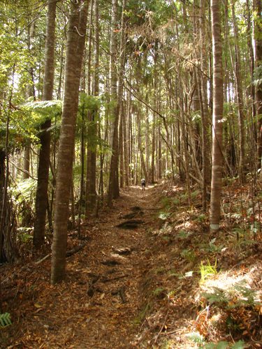
Take the Anderson Track to the junction with West Tunnelmouth Track. (1.8km) This section is quite steep, but otherwise manageable. Walk at a pace that suits you.
As we near the top of the ridge there's an area of young kauri that is quite special
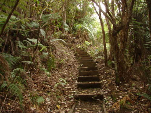
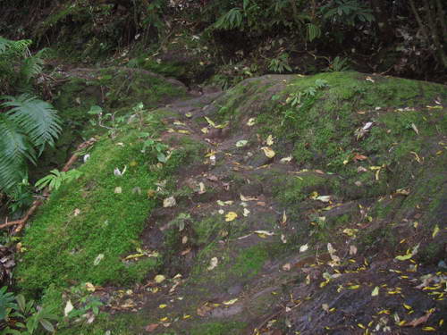
Follow the Western Tunnelmouth Track, straightforward, to the western tunnelmouth. (Well, duh!) (2.3km) Near the end of this track is a short (3-4m) section of slippery, almost bare rock to edge down, with barely visible cut steps.
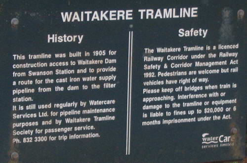
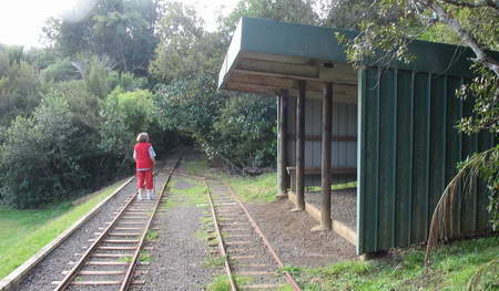
I've seen joggers take this without pausing. I take a minute or two. There's nowhere a stick can get a good purchase. Follow the track beside the railway line to the Waitakere Dam. (3.9 km)
Part way along is a tunnel
and several bridges that we share with the railway.
It's a level walk and there's a spot along the way to sit and enjoy a bite to eat.
You might even get to see a train coming past. Toilet facilities are available at the dam. From there, there's a tarseal service road with broad lawn edging taking you up to Scenic Drive. (5.2 km)
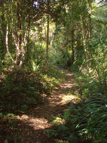
If you want to, you can bail here for the day. If you still have bags of energy, turn left along Scenic Drive, watching carefully for cars. There's no footpath. After about 400m the Filter Track heads off to your right from the Scenic Drive, and after about 10-15 minutes gentle tramping,
heads fairly steeply downhill towards the big filter station. The track is rough in places, and rougher in others, but take it slowly and it can be done.
(I managed it at 140kg and 68 years old, so it's not impossible, but your legs would need a little previous training. It's downhill, and requires care rather than strength. Sticks are probably essential for stability, and I'd likely not try it after recent rain. You won't fall over a cliff or anything but it would be very easy to slip in wet weather. Fatman time, 70 minutes. There are some nice kauri to stop with and enjoy on the way down.
At the bottom, (6.5km) you'll strike a service road, and along the way a little to the right, the collection of buildings and so forth that make up the filter station.
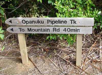
This is another possible terminus for the days walking. Bring your car in via Christian Rd, and park outside the gates to the filter station.There's a public toilet here. Otherwise, head right through the collection of buildings, and at the far end, across a section of lawn, you'll see the start of the Opanuku Pipeline Track.
(NB Make sure you dont confuse this with the Swanson Pipeline Track which begins a short way down a side road from the filter station) Follow the Opanuku Pipeline Track through a (short) tunnel, downhill and over a bridge to a campground by the stream. The track is broad, originally intended for vehicles, but now somewhat eroded and slippery when wet. Then follow the gravelled service road up to Mountain Rd. (8km)
There are 2-3 carparks available at the Mountain Rd end of the track. Tomorrow's walk begins just up the hill. Turn left from the end of the track to get to Henderson. At this point, I have assembled no information regarding accommodation in the area. This is work in progress and I'll post it as soon as I get it together.
|
|

 kauri upper.jpg)